ML for Tropical Deforestation Analysis
| Links:
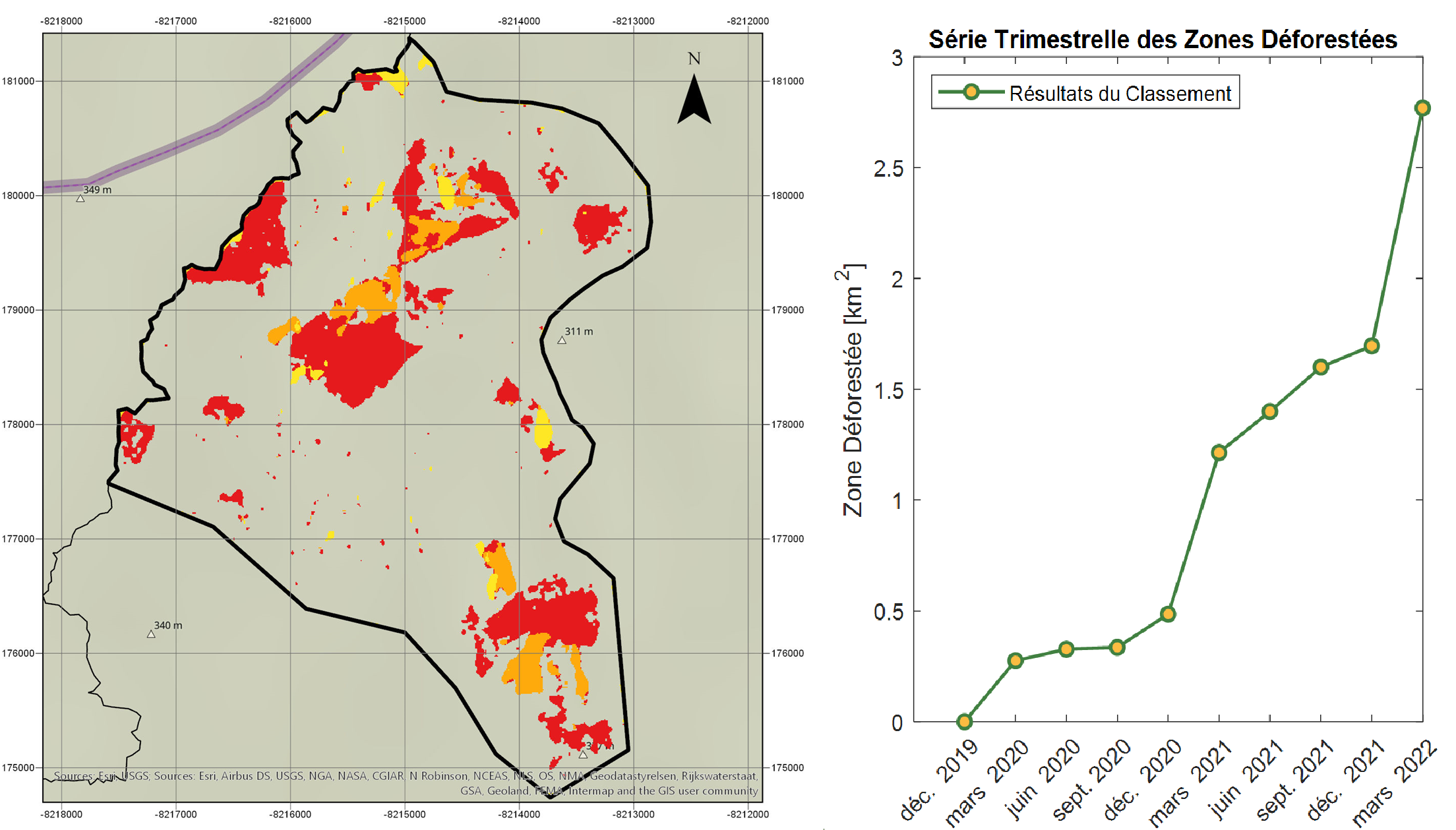
Tropical deforestation for increasing agricultural or pasture area has associated problems of climate change and biodiversity disapearance. This phenomenon also takes place in protected areas and it is important to detect it to tackle the problem and introduce preventive measures for its control. This project evaluated the progress of the deforestation on a trimestral basis from 2019 to 2022 in the National Park of Chiribiquete in Colombia by using the satellite images provided by Sentinel-1 with a spatial resolution of 10 m. The work showed Sentinel-1 images to be a good way to assess deforestation in tropical rainforest areas with high frequency, something difficult to be done with optical images in this type of areas due to extense and common presence of cloud coverage.
The pre-processing of the images was done in Google Earth Engine, resulting in 10 normalized trimestral RGB composites. A 3-fold cross validated random forest pixel-based classification model was trained and validated with Planet database reference data. Finally, the post-processing of the images consisted on a median filter to obtain a deforestation change map and the deforested area evolution curve.